Geographic Information Systems Technology
Nearly a quarter of your life is spent at work! Choosing a career isn’t easy but it certainly is one of the most important choices you will make. You need to make sure you understand the skills required for the career path you choose so your career choice will be as close to your “dream job” as possible. Are you detail oriented? Do you enjoy problem-solving? Do you work well with others? Are you always interested in learning new skills? Do you possess excellent oral and written communication skills? These are the skills and characteristics possessed by most successful Geographic information systems techs.
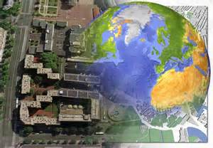
You might want to explore the Geographic Systems Technology program at Hinds Community College. This program prepares a person for entry-level positions in the geographical information systems field. A geographic information system, or GIS is a combination of map-making and data base technology. A GIS stores, analyzes and manages location-linked data. In perhaps overly simplistic terms, a GIS is a spatial mash-up of data. A GIS uses mapping software along with remote sensing, surveying, aerial photography, and ground truth data. A good GIS allows informative displays of geographic information that may relate to any type of information: medical, socio-economic, demographic, or any other type of information that can be put on a map. GPS navigation programs that people have in their cars or on their cell phones are a GIS application. The wide applications of GIS in dozens of industries has made the position of GIS technician increasingly important.
What Do GIS Technicians Do?
- Research and test new data sources, software, and organizational tools.
- Create and implement standards for quality of geographic data.
- Design, develop, and implement systems and databases for storing and accessing geospatial data.
- Standardize and define metadata for geographic data, and track need for data format conversion.
The curriculum includes computer-assisted drafting, map making, database management, surveying, and applications of geographical information systems. GIS technicians work under the supervision of GIS engineers, managers, cartographers, surveyors, and other professionals to store, organize, retrieve, and analyze resource data for planning and decision making. The need for technicians in this area continues to grow with the rapid development and implementation of GIS technology.

Will I Be Able To Find Employment?
According to the United States Bureau of Labor Statistics, jobs related to and including GIS Technicians is expected to experience a 21% increase through 2016. According to Simply Hired, an entry level GIS technician earns, on average, an annual salary of $32,000. More generally, a GIS tech can earn anywhere from $25,000 to $60,000, depending upon education level, experience, and work location. Recent advancements in mapping technology have led to new uses for maps and a need for more of the data used to build maps. The digital revolution in mapmaking has created a need to make maps based on data fed into a geographic information system (GIS).
Municipalities are finding that putting all the information about wires, pipes and other underground infrastructure onto one map is crucial in implementing systems integration. This enables them to upgrade the entire infrastructure under a street at the same time, and thus have all needed construction done as one project. This coordination of all such construction projects results in savings for the local government.
Students will find the Geographic Information Systems Technology program at Hinds Community College a reliable and thorough training ground for employment in a wide range of fields. . A typical sampling of positions filled by students who have completed this program include. GIS specialist, GIS technician, GIS data specialist, GIS data analyst, and GIS assistant.
Need More Information?
This program is located on the Jackson ATC campus of Hinds Community College. For more information, contact Tony Howard at TCHoward@hindscc.edu or 601.987.8111.


